Introduction.
One of my passions is historic preservation, acts of man that always requires SOMEONE to take an aggressive action and make a compelling argument for saving something of historic significance from destruction, and thereby saves that significant something for the likes of me to enjoy today.
This passion often lifts my heart, and sometimes, actually more often than not, it breaks it.
Over the past year I’ve worked extensively with the Mosby Heritage Area Association (MHAA), a foundation here in northern Virginia dedicated to educating others about the rich history and early cultures of northern Virginia, including Loudoun County. Loudoun County is less than 200 miles away from Jamestown, Virginia, first settled in 1620. Settlers began moving into Loudoun County about 1730. Thus, there’s a lot of historic evidence here to save. Every time I find it still here to admire, my heart is lifted. Sadly, there’s a lot of history that’s been lost forever: …burned…plowed….recycled……destroyed.
Every month I write an article and produce a photographic gallery for readers of the MHAA news letter. I’m going to duplicate them here to hopefully reach a wider audience for the information. Since I’m potentially reaching an audience that’s not as familiar with Virginia history and geography, I’ll also include maps and other information to help you connect and get more out of the articles.
Here’s what I want to happen: 1)You’ll learn more about the history of colonial America and it many peoples; 2) you’ll learn about the various groups and government organizations that advocate historic preservation across the entire Country–solely for our benefit and that of our children; and 3) you’ll gain an appreciation for the hardships, lifestyles, craftsmanship, and entrepreneurial spirit of early America.
Where it began…

Along with German squatters and migrating Quakers, a number of Tidewater Virginia landowners leased large tracts of land from agents of Lord Fairfax and established their own forms of agriculture and human culture. They brought the plantation economy–and tragically the slaves who made it profitable– to northern Virginia and grew tobacco and grain.
So it was that Loudoun County was a cultural “mixing bowl” from its beginning: by 1750 its inhabitants included native Americans, Quakers, Germans, Africans, Dutch, English, French, Irish, Scottish, and Welsh. This cultural mix led to many diverse architectural styles and a great diversity of religious, political, economic, and social lifestyles.
Taylorstown Historic District
The small hamlet of Taylorstown, Virginia was among the earliest villages in Loudoun to be settled by the Germans and Quakers. Taylorstown has two of the oldest standing houses in Loudoun County, “Hunting Hill” and “Foxton Cottage”, directly across the Catoctin Creek from each other. The historic district itself is listed on both the National Register of Historic Places and the Virginia Landmarks Register.
Taylorstown sits on the banks of the Catoctin Creek about two miles south of the Potomac River. Devout Quaker Richard Brown from Bucks County Pennsylvania was probably its first resident. He arrived in 1730 to find a site for a milling operation. Finding Catoctin Creek to be the ideal location, he acquired several hundred acres and established a milling operation along its banks “where the water flow was sufficient.”
Between 1734-1737, Brown constructed a small, one-and-one-half-story stone dwelling that sits atop a hill to the north of the present mill. This dwelling, known as Hunting Hill, is thought to be the oldest standing building in Loudoun County.
Essentially unaltered from its original building, Hunting Hill has a German plan consisting of a large hall and two smaller chambers separated from the hall by a board partition. The hall is heated by a large fireplace centered on the west wall.

The village of Taylorstown has always been tightly linked with its old stone mill. It is a real treasure, as the majority of mills in Loudoun County, a county once known for its many mills, have disappeared. And although numerous such milling communities survive across the state, few possess a setting so scenic or a collection of historic sites of such interesting diversity as the tiny hamlet of Taylorstown.In 1784, Richard Brown’s son, Mercer Brown, sold the old log mill and family farm to Thomas Taylor, a wealthy Quaker from Frederick County, Maryland. After establishing himself here, Taylor began selling off half- acre lots near the mill, and the resulting small community came to be called Taylors Town. Taylor’s son Henry built the present stone mill in 1796-1800, making it the oldest of 5 remaining mills in Virginia thought to have been built in the late 1700s.
The Taylorstown Mill was continuously in operation until 1911, when its water wheel was sold to the nearby Oatlands Mill and the mill converted to steam power. In 1932, the steam engines were removed and the Mill became a feed store until bought in the late 1950s and restored. Since the late 1960s, Taylorstown Mill has been a private residence.

By the mid-1800s, the Taylorstown area was one of the most densely populated areas of Loudoun County. The town had a post office, a blacksmith’s shop, 2 mills, a U.S. Government-operated still, general and supply stores, a movie theatre, and a school. In 1850 the mill was one of thirty water-powered mills collectively processing a half-million bushels of wheat in Loudoun County, making Loudoun one of the state’s leading flour producers at that time.
The year 1932 was disastrous for Taylorstown. The school closed, the main stored burned, the post office closed, and the mill stopped operating. A new store opened in 1938 that can be seen today. It remained the main town store until its owner, Mrs Annie Elizabeth Mann, died in 1976.
The story of Thomas Taylor is an original “American Story.” The family chronicles say that he came to the colonies as an indentured servant in 1743. He was 13 at that time. When he turned 21 he received a land grant from Lord Calvert in Maryland and began acquiring other tracts in the area. He and his wife raised 7 children. The six girls required ‘finishing’ school in Baltimore and the finest in clothing, which Quaker Taylor was able to provide at much expense. But to his son Henry, he left the mill property and 200 acres in 1797. The community prospered under Henry’s management, and in 1833 the first reference to “Taylor Town” was made in a deed of transfer.
Foxton Cottage
Not much is known about Foxton Cottage. The original structure, probably built circa 1800, is thought to be a patent house designed by William Penn as a model “frontier house.’ It was probably first acquired by Philip Souder as part of 126 acres he obtained from Charles Bennet, 3d Earl of Tankerville, who began selling off 100 acre tracts of his massive Catoctin Manor in 1789. The present-day patent house is completely preserved, quaintly situated alongside the west creek bed at the end of a winding lane, and is a private residence.

Trouble during the Civil War
For most of the area’s history, the Quakers, Germans, and Tidewater families lived and worked in harmony. But as Virginia entered the mid-1800s and the talk of succession heated up, harmony turn to animosity. For the pacifist Germans and Quakers living in northern Loudoun County, military service during the Civil War was indeed contentious. Forced to choose, many joined one side or the other. Some joined the independent Loudoun Rangers, 2 Companies organized to “hamper” the Confederates and directed by the Union Army. Those who joined the Loudoun Rangers included many devout Quakers. Charles Means of Waterford, first Commander of the Rangers, was himself a Quaker. It was the only Union military unit ever established within the Confederacy.
The Confederates also established a battalion here, nicknamed “White’s Comanches” and led by Lt Col Elijah White from Leesburg. Both Means and White recruited from exactly the same areas within Loudoun County, so the same family names were found on the rosters of each. Thus, the relationship between the two units (and between families) was especially antagonistic. Both units were fighting on their home territory, often brother against brother, soldiers from both units courted the same local girls, and they attended the same parties. Every interaction was an opportunity to ‘engage the enemy,’ and each side exploited every opportunity.
The area was subjected to Sheridan’s burning raids in 1864; the result was catastrophic for both Federal and Confederate sympathizers. General Merritt was ordered to “..consume and destroy all forage and subsistence, burn all barns and mills, and their contents, and drive off all stock in the region ..” of Loudoun County. The 5 days of raids resulted in great destruction of property and loss of livelihood. General Merritt’s preliminary report said that “..from 5000-6000 head of cattle, 3000-4000 head of sheep, and 500-700 horses had been driven off, while 1000 head of fatted hogs had been slaughtered.” It listed as burned 230 barns, 8 mills, 1 distillery, 10,000 tons of hay, and 25,000 bushels of grain.
The Catoctin Valley was, and likely remained so for decades following the War, a torn fabric of community.
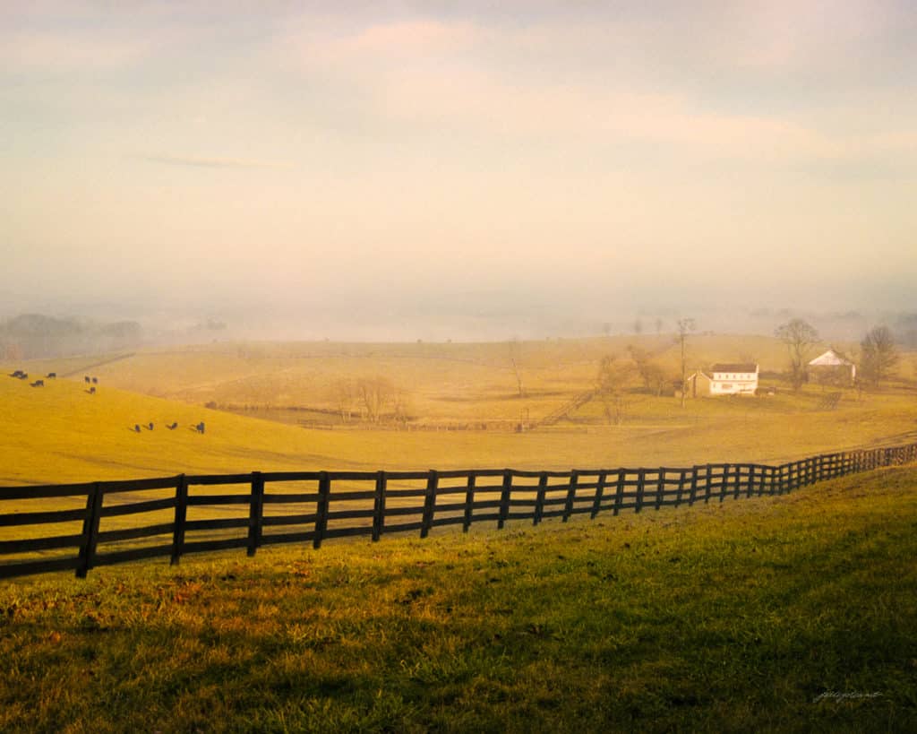
Today the area surrounding Taylorstown is beautiful open rolling hills, pastures, and abundant streams. Where once many villages stood, there is but little evidence. A once vibrant milling economy never recovered from the Civil War.

For more images of the area visit my photo gallery by clicking Here or paste www.pbase.com/mosbyheritage/taylorstown into your browser.
You’re invited to also visit my online image gallery !